Topographic Map Mystery: Geology's Unrecognized Paradigm Problem


Topographic Map Mystery: Geology's Unrecognized Paradigm Problem
Topographic Map Mystery: Geology's Unrecognized Paradigm Problem
Member Benefits
 30% Off All Books - Savings that support storytellers, not stock prices.
 Fight Book Bans - Every membership sends a book to LGBTQ+ youth in affected states.


Couldn't load pickup availability
Description
Description
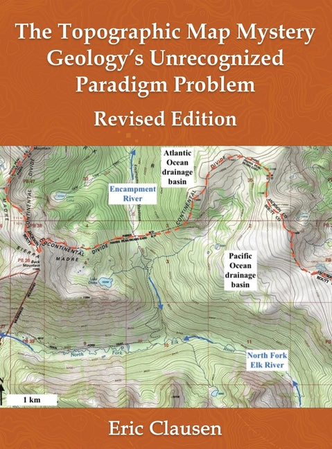
Most drainage system and erosional landform features as mapped on United States Geological Survey topographic maps represent anomalous evidence which the accepted Cenozoic geology and glacial history research community has almost always ignored. These features blanket most continental land areas and include river and stream valleys, drainage divides, mountain passes, through valleys (valley crossing drainage divides), canyons cut across mountain ranges, water gaps, wind gaps, abrupt river and stream direction changes, barbed tributaries, erosional escarpments, and many other similar features. How can the geology research community claim to understand Cenozoic geology and glacial history when geologists have never determined what the well-mapped topographic map drainage system and erosional landform evidence has to say?
Publishing Information
Publishing Information

The Allstora Membership
Membership Perks:
- Save 30% on all online store purchases
- Exclusive access to author's content
- You pay less, but authors still earn double
Membership Terms:
- To access membership discount simply log in and add to cart, discount applied automatically.
- One month free trial, cancel anytime. Membership renews on the 15th of each month.